

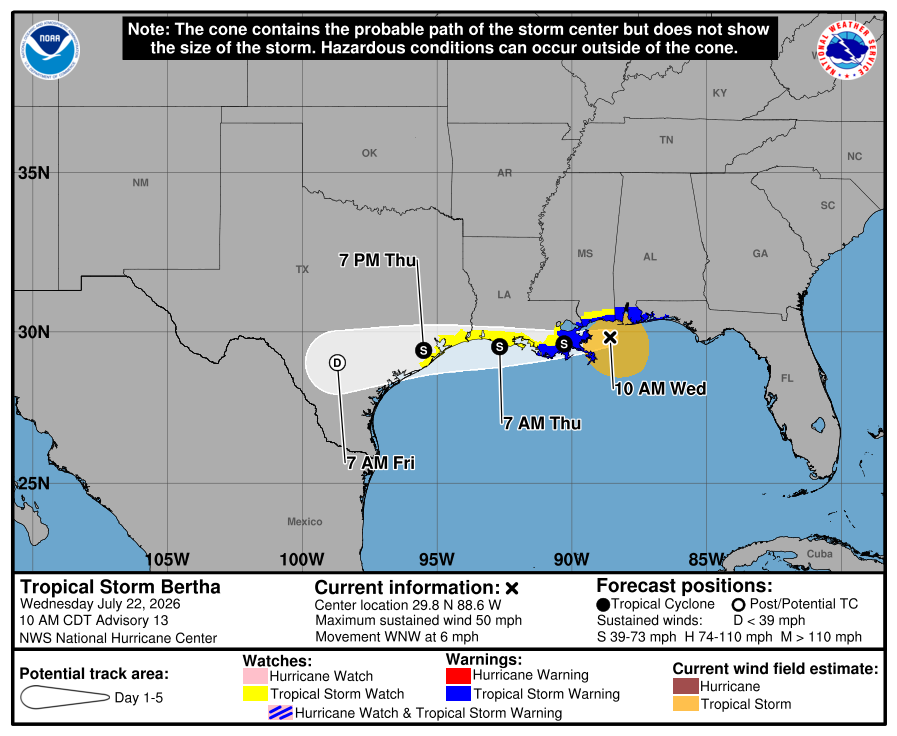
A tropical storm watch has been issued for Brazoria, Chambers and Galveston counties as Tropical Storm Bertha moves slowly through the Gulf.
The storm is expected to approach the upper Texas coast late Thursday morning or early Thursday afternoon, according to forecast information released Wednesday morning by the National Weather Service. The watch, which means tropical storm conditions are possible, is in effect through 6 a.m. Friday.
“There's a lot of uncertainty still with the intensity,” National Weather Service meteorologist Hayley Bailey told Houston Public Media on Wednesday morning. “We do have northeasterly shear that has been developing and increasing, and that's going to play heavily into how this storm evolves over the next couple of days."
As of 10 a.m. Wednesday, the storm had sustained wind speeds of 50 mph, according to theNational Hurricane Center. Tropical storm conditions were expected to continue through Wednesday night along the northern Gulf Coast, between the western Florida panhandle and southwestern Louisiana, including the New Orleans metro area.
The system is expected to reach Texas as a weak tropical storm before downgrading to a tropical depression once it makes landfall, the National Weather Service said in a Wednesday morning advisory. Bertha is expected to bring scattered showers and thunderstorms to the Houston region late Thursday into early Friday, although the risk for excessive rainfall and flash flooding is “marginal,” according to the weather service.
"The latest forecast for today through Saturday morning is honestly less than an inch,” Bailey said, speaking about the Houston and Galveston region. “Closer to the coast, of course expecting generally a half an inch or an inch. So it looks like most of the rainfall is expected to stay offshore with this storm."
At 7 p.m. Monday, the National Hurricane Center officially upgraded the storm from a tropical disturbance to Tropical Storm Bertha. It is the second tropical storm this hurricane season after Tropical Storm Arthur formed in the western Gulf in mid-June and brought heavy rain and strong winds to coastal areas including Galveston.
Cameron Self, a meteorologist at the National Weather Service’s Houston/Galveston office, said Monday thatweather-monitoring planes from the U.S. Air Force and the National Oceanic and Atmospheric Administration (NOAA) began flying into the system Sunday evening and will continue to monitor it as it makes its way through the Gulf.
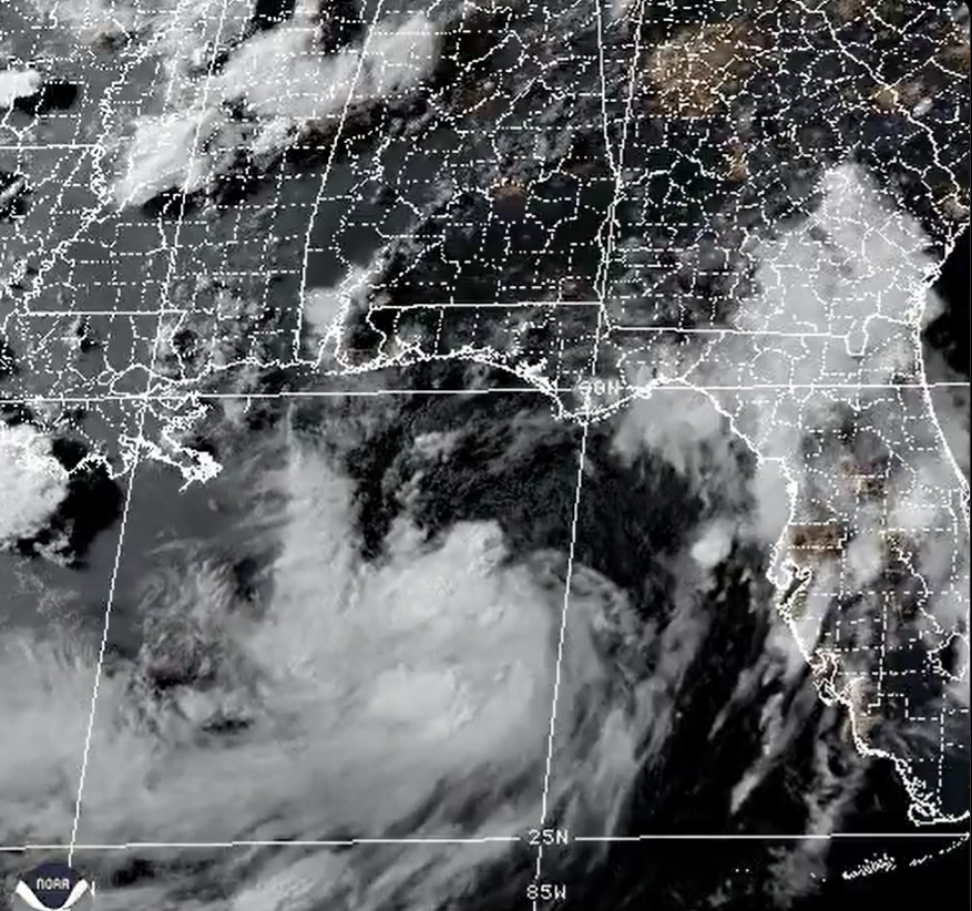
"Even though right now the forecast is not showing significant impacts to our area, any storm in the Gulf is worth keeping tabs on," Self told Houston Public Media on Monday morning. "So we'd recommend checking on the [depression] at least once a day just in case."
Self said Monday the forecast would solidify throughout the week.
"Currently it is still in the northeast Gulf, and it's moving very slowly to the northwest," Self said. "We do expect it to turn more toward the west in the general direction of Texas, but the system does have some hurdles it's going to have to get through before it's able to get here."
One of the potential hurdles is if the system makes landfall in Louisiana, Self said.
"If that's the case, that'll take the system from being over the Gulf to over land, which would certainly limit the amount that it could intensify, if not weaken it," he said. "Also there's a lot of shear and dry air that it's dealing with."
However, the system is still expected to strengthen before the end of the week, Self said.
"The conditions are not necessarily so unfavorable to where the system can't strengthen,” he said. “It likely is going to strengthen some ... but right now as it stands, it's not looking like a major impact to Southeast Texas."
Houston Public Media’s Matt Harab Rob Salinas contributed to this story.
Editor’s note: This article has been updated through July 22, 2026, based on the latest weather forecast information.
Copyright 2026 Houston Public Media News 88.7